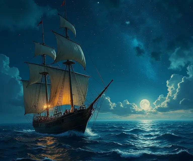
For millennia, before the advent of GPS and sophisticated electronic instruments, humans relied on a breathtakingly accurate, yet seemingly mystical, skill to traverse the vast oceans: navigation by the stars. It wasn’t magic, but a complex and refined science, born of observation, mathematics, and a deep connection to the natural world. This article delves into the fascinating history and techniques of celestial navigation, exploring how ancient mariners transformed the night sky into a global map.
A History Rooted in Observation
The earliest forms of navigation were, naturally, coastal. Sailors stayed within sight of land, using landmarks as guides. But the human desire to explore, to trade, and to understand the world beyond the horizon inevitably led to venturing out of sight of land. This is where the stars came into play. The origins of stellar navigation are shrouded in the mists of time, but evidence suggests that Polynesian voyagers were among the most skilled early celestial navigators, developing their techniques over thousands of years, beginning around 1500 BC. Their feats of open-ocean navigation, reaching islands scattered across the Pacific, were remarkable, achieved with only a profound understanding of the stars, waves, winds, and bird flight patterns.
Around the same period, the ancient Egyptians and Mesopotamians were also observing the stars, primarily for astrological and religious purposes. However, their astronomical observations laid the groundwork for later navigational advancements. The Phoenicians, renowned seafarers of the ancient world (c. 1500 – 300 BC), used the North Star (Polaris) to maintain a consistent course. The Greeks, building upon earlier knowledge, began to develop more systematic approaches to astronomy and navigation. Ptolemy’s Almagest, a comprehensive astronomical treatise completed in the 2nd century AD, became a foundational text for navigators for over 1400 years.
The Arabs, during the Islamic Golden Age (8th – 13th centuries AD), made significant contributions to astronomy and navigation. They refined astronomical instruments like the astrolabe, which allowed for precise measurements of the positions of celestial bodies. Arabic sailors dominated trade routes in the Indian Ocean and beyond, using their astronomical knowledge to navigate accurately. In Europe, the rediscovery of classical texts, including Ptolemy’s work, during the Renaissance spurred renewed interest in astronomy and navigation. The Age of Exploration, beginning in the 15th century, was fueled by advancements in navigational techniques, including improvements in the astrolabe, quadrant, and cross-staff.
Key Celestial Bodies and Concepts
Celestial navigation revolves around identifying and measuring the angles between celestial bodies – the sun, moon, stars, and planets – and the horizon. These measurements, combined with accurate timekeeping and astronomical tables, allow navigators to determine their latitude (north-south position) and longitude (east-west position).
Latitude: Determining Your North-South Position
Determining latitude is relatively straightforward. The altitude of the sun at noon (local apparent noon, when the sun reaches its highest point) is a direct indicator of latitude. For example, if the sun is directly overhead (90° altitude), you are at the equator. The further north or south you travel, the lower the sun’s maximum altitude will be. The North Star (Polaris) is particularly useful in the Northern Hemisphere. Its altitude above the horizon is approximately equal to your latitude. Ancient navigators used tools like the quadrant or astrolabe to measure these angles.
Longitude: The Greater Challenge
Determining longitude, however, presented a far greater challenge. Unlike latitude, there’s no fixed reference point in the sky to easily measure east-west position. Longitude requires knowing the precise time difference between your location and a designated prime meridian (originally Greenwich, England). For centuries, this was incredibly difficult to achieve accurately. A difference of just one minute of longitude equates to approximately one nautical mile (1.15 statute miles). Early attempts involved observing the positions of celestial bodies and comparing them to their expected positions based on the prime meridian time. But accurately keeping time at sea was a major obstacle.
The solution came with the invention of the marine chronometer by John Harrison in the 18th century. This remarkably accurate clock, unaffected by the ship’s motion, allowed navigators to determine longitude with unprecedented precision. Before the chronometer, navigators relied on lunar distances (measuring the angular distance between the moon and specific stars) and dead reckoning (estimating position based on course, speed, and time), both of which were less accurate.
Important Celestial Bodies
- The Sun: Used for determining latitude at noon.
- Polaris (North Star): Indicates latitude in the Northern Hemisphere.
- The Moon: Useful for determining longitude (especially before the chronometer).
- Bright Stars: Provide reliable reference points for measuring angles.
- Planets: Can be used, but their positions are more complex to calculate due to their movement.
Navigational Instruments
Over time, a variety of instruments were developed to aid in celestial navigation. Here are some of the most important:
- Astrolabe: An ancient instrument used to measure the altitude of celestial bodies.
- Quadrant: Similar to the astrolabe, but simpler in construction.
- Cross-staff (Jacob’s Staff): A long staff with perpendicular cross-pieces used to measure angles between the horizon and stars.
- Sextant: The most accurate and versatile instrument for measuring angles, widely used from the 18th century onwards.
- Marine Chronometer: A highly accurate clock essential for determining longitude.
- Nautical Almanac: A publication containing tables of the positions of celestial bodies at specific times.
The Process of Celestial Navigation: A Step-by-Step Overview
While the specifics can be complex, the basic process of celestial navigation involves these steps:
- Observation: Using a sextant, measure the altitude of a celestial body (sun, star, planet, or moon) at a specific time.
- Timekeeping: Record the precise time of the observation using a marine chronometer.
- Identification: Identify the celestial body observed.
- Calculation: Using a nautical almanac and spherical trigonometry, calculate your latitude and longitude based on the observed altitude, time, and identified celestial body.
- Plotting: Plot your calculated position on a nautical chart.
This process often involves taking multiple observations of different celestial bodies to improve accuracy and confirm the results. It requires meticulous attention to detail, a solid understanding of mathematics, and a thorough knowledge of astronomical tables.
Polynesian Wayfinding: A Different Approach
While European navigation relied heavily on instruments and mathematical calculations, Polynesian wayfinding employed a different, more holistic approach. Navigators, known as wayfinders, memorized vast amounts of information about the stars, wave patterns, wind directions, bird flight paths, and even the smell of different islands. They didn’t use instruments in the same way as Europeans, but rather developed a deep intuitive understanding of their environment. They created ‘stick charts’ – complex arrangements of shells and sticks representing wave patterns and island locations – as memory aids. This knowledge was passed down through generations in the form of oral traditions and practical training. The reliance on observation and memory is a fascinating parallel to other cultural traditions.
The Decline and Resurgence of Celestial Navigation
With the advent of GPS and electronic navigation systems in the 20th and 21st centuries, celestial navigation largely fell into disuse. However, it hasn’t been entirely forgotten. Many maritime academies and naval institutions still teach celestial navigation as a backup skill in case of electronic failures. Furthermore, there’s a growing resurgence of interest in traditional navigational techniques as a way to reconnect with the natural world and appreciate the ingenuity of past generations.
Why Study Celestial Navigation Today?
Even in the age of GPS, understanding celestial navigation offers several benefits:
- Backup Skill: Provides a reliable method of navigation in case of electronic failures or disruptions.
- Deeper Understanding of the World: Cultivates a greater appreciation for astronomy, geography, and the history of exploration.
- Enhanced Situational Awareness: Encourages a more mindful and observant approach to the environment.
- Connection to History: Allows you to connect with the skills and knowledge of ancient mariners.
Learning celestial navigation is a challenging but rewarding experience. It’s a journey into the heart of a lost art, a testament to human ingenuity, and a reminder of our enduring connection to the stars.
Here’s a helpful instructional video:
Further exploration into related areas of historical knowledge can be found by exploring ancient weather prediction techniques, or delving into the origins of seafaring superstitions. The study of heraldry can also reveal fascinating insights into the maritime cultures of the past. And if you’re interested in how humans perceive the world around them, consider the science of smell and its role in navigation and cultural memory.

 The Curious Mechanics of Celestial Globes: Mapping the Heavens in Miniature
 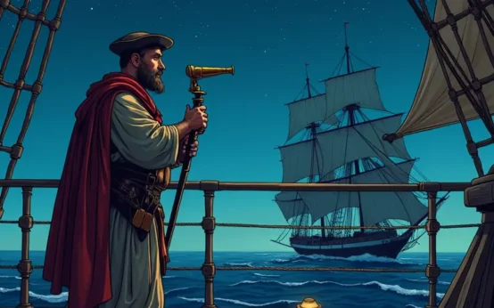 The Curious Chronicle of Celestial Navigation: Stars, Sextants, and the Art of Finding Your Way
 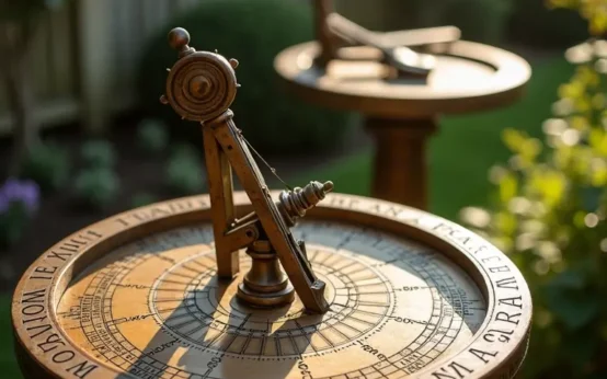 The Surprisingly Consistent Science of Antique Sundials – Shadow, Time & Celestial Alignment
  The Unexpectedly Consistent Science of Bird Migration: Navigating by Stars, Senses, and Ancient Routes
  The Surprisingly Durable Legacy of Ancient Roman Concrete
  The Unexpected Role of Bees in Ancient Timekeeping