For millennia, humans have been obsessed with representing the world around them. From cave paintings depicting hunting grounds to modern GPS systems, the desire to understand and portray our planet has driven innovation and creativity. But representing a three-dimensional sphere on a two-dimensional surface is inherently problematic. This is where map projections come in—and surprisingly, the scientific principles underlying these projections have remained remarkably consistent throughout history, even as our understanding of the Earth itself has evolved. This article will delve into the fascinating world of early map projections, exploring the challenges, the ingenious solutions, and the enduring scientific principles that shaped how we’ve visualized our world.
The Fundamental Problem: Spheres and Planes Don’t Mix
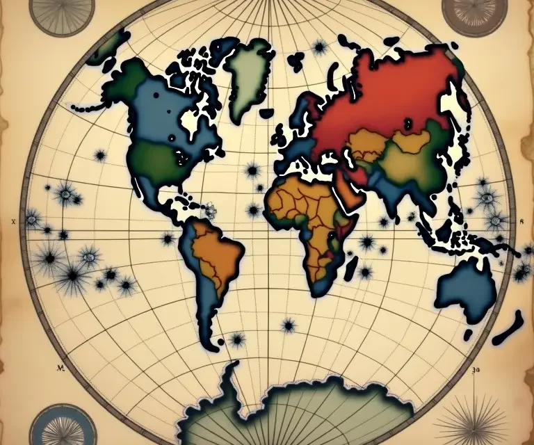
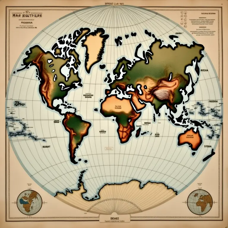
Imagine peeling an orange and attempting to flatten the peel without tearing or stretching it. It’s impossible. This simple analogy illustrates the core problem of map projections: you can’t perfectly represent a sphere on a plane. Any attempt to do so will inevitably result in distortion. This distortion manifests in three primary ways: area, shape, distance, and direction. A map can preserve one or two of these properties accurately, but it’s impossible to maintain all four simultaneously.
- Area (Equal-Area Projections): These projections accurately represent the relative sizes of landmasses. However, they often distort shapes significantly.
- Shape (Conformal Projections): These projections preserve local shapes and angles, making them useful for navigation. However, they distort areas, particularly at higher latitudes.
- Distance (Equidistant Projections): These projections maintain accurate distances from one or two specific points. However, they distort both area and shape.
- Direction (Azimuthal Projections): These projections preserve accurate directions from a central point. They distort area and shape considerably as you move away from that center.
Early mapmakers were acutely aware of these distortions, even if they didn’t possess the mathematical tools to fully quantify them. Their choices of projection weren’t arbitrary; they were driven by the specific purpose of the map and the priorities of the culture creating it.
Ancient Roots: From Practicality to Cosmology
The earliest maps weren’t about precise geographical representation in the way we understand it today. They were often functional tools for navigation, land surveying, or symbolic representations of the cosmos. The Babylonians, as early as the 6th century BC, created clay tablets depicting their known world – a relatively small area centered around Mesopotamia. These weren’t projections in the modern sense but rather schematic representations of cities, rivers, and regions.
The ancient Greeks, however, began to grapple with the problem of representing the entire known world on a flat surface. Anaximander (610-546 BC) is credited with creating one of the earliest known world maps, a circular map with Greece at the center. While rudimentary, it demonstrates an understanding of the Earth’s spherical nature. His map wasn’t a precise projection, but rather a conceptual representation.
Eratosthenes (276-195 BC), famed for his remarkably accurate calculation of the Earth’s circumference, also created detailed maps. While his original maps haven’t survived, descriptions suggest he used a conical projection, a method that would become increasingly important in later centuries. This projection involved wrapping a cone around the globe and projecting the features onto the cone’s surface, then unrolling the cone to create a flat map. Conical projections are particularly useful for mapping regions with east-west orientations, as they minimize distortion along parallels.
Ptolemy’s Revolution and the Planispheric Projection
The most influential early map projection was developed by Claudius Ptolemy (c. 100 – c. 170 AD), a Greco-Egyptian astronomer, mathematician, and geographer. His Geographia, a comprehensive treatise on cartography, contained detailed maps of the known world, based on a conical projection. However, Ptolemy didn’t just use a simple conical projection; he combined it with principles of triangulation and coordinate systems (latitude and longitude) to create a remarkably sophisticated mapping system for his time.
Ptolemy’s maps, while containing significant errors (particularly in estimating the size of the Earth and the extent of Asia), became the standard reference for over 1400 years in Europe and the Middle East. His projection, known as the planispheric projection, was particularly impactful. It’s a two-dimensional representation of the globe, displaying the continents, oceans, and major cities in a familiar, albeit distorted, form.
The key to understanding Ptolemy’s projection lies in its use of coordinate systems. By assigning coordinates to locations on the Earth, he could mathematically project these points onto a flat surface. This approach, while not without its limitations, laid the groundwork for modern map projections. It’s a testament to the power of mathematical principles applied to geographical representation. For more on the consistent application of scientific principles throughout history, consider reading about /the-unexpectedly-consistent-science-of-soapmaking-from-ancient-recipes-to-modern-chemistry/.
The Islamic Golden Age: Refining and Expanding Knowledge
During the Islamic Golden Age (8th to 13th centuries), scholars built upon the work of the Greeks, particularly Ptolemy. Al-Idrisi (1100-1165), a Moroccan geographer, created a detailed world map for King Roger II of Sicily. His map, while influenced by Ptolemy, incorporated new information gathered from Arab travelers and explorers, offering a more accurate representation of Africa and Asia. Al-Idrisi also refined the use of projections, experimenting with different techniques to minimize distortion.
Islamic scholars also made significant advancements in mathematics and astronomy, further refining the tools necessary for accurate mapmaking. They improved astronomical instruments, developed more precise methods for determining latitude and longitude, and contributed to the development of trigonometry – all essential components of cartography.
The Renaissance and the Age of Exploration: New Worlds, New Projections
The Renaissance and the Age of Exploration brought a surge in geographical knowledge and a renewed interest in mapmaking. As European explorers charted new lands, the limitations of Ptolemy’s projection became increasingly apparent. The discovery of the Americas necessitated a re-evaluation of existing maps and the development of new projections that could accurately represent the entire globe.
Gerardus Mercator (1512-1594), a Flemish cartographer, revolutionized mapmaking with his cylindrical projection, published in 1569. The Mercator projection, designed specifically for navigation, preserves angles and shapes, making it ideal for plotting ship routes. However, it dramatically distorts areas, especially at higher latitudes, making Greenland appear much larger than it actually is. Despite this distortion, the Mercator projection became the standard for nautical charts and remains widely used today.
The Mercator projection’s success wasn’t accidental. Mercator understood the trade-offs inherent in map projections and consciously chose to prioritize shape and direction over area. This decision reflected the needs of sailors, who needed accurate bearings and rhumb lines (lines of constant compass direction) for navigation.
The Consistency of Scientific Principles
Throughout these historical periods, a remarkable consistency in the *scientific* approach to map projections is evident. Even when the understanding of the Earth’s shape and size was incomplete, mapmakers were applying fundamental mathematical and geometric principles to solve the problem of representing a sphere on a plane. They were consciously making choices about which properties to preserve and which to sacrifice, based on the intended use of the map.
This isn’t to say that early map projections were “accurate” in the modern sense. They were often based on limited data and imperfect assumptions. However, the underlying principles – the mathematical relationships between points on a sphere and their projections onto a plane – remained consistent. The evolution of map projections wasn’t a rejection of earlier methods; it was a refinement and expansion of them, driven by new knowledge and new needs. Just as the principles of horology have remained consistent over centuries, as explored in /the-surprisingly-consistent-science-of-clock-chimes-history-harmony-and-horology/, the core science of map projections has shown remarkable durability.
Beyond Geometry: The Role of Cultural Context
It’s crucial to remember that map projections aren’t purely scientific endeavors. They are also shaped by cultural context and the worldview of the mapmaker. The choice of a particular projection can reflect power dynamics, political agendas, and ideological beliefs.
For example, Eurocentric projections, such as the Mercator projection, often place Europe at the center of the map, implicitly reinforcing a sense of European dominance. Other projections, such as the Gall-Peters projection, attempt to correct this bias by accurately representing the relative sizes of landmasses, even at the expense of shape distortion.
The act of mapmaking is, therefore, inherently subjective. A map isn’t a neutral representation of reality; it’s an interpretation of reality, shaped by the values and perspectives of its creator. Understanding this inherent subjectivity is essential for critically evaluating maps and recognizing the biases they may contain.
The Enduring Legacy: Modern Map Projections
Today, we have a vast array of map projections to choose from, each with its own strengths and weaknesses. Modern projections are often developed using sophisticated computer algorithms and based on a precise understanding of the Earth’s shape (which, incidentally, isn’t a perfect sphere – it’s an oblate spheroid).
However, the fundamental principles established by early mapmakers remain relevant. We still grapple with the same trade-offs between area, shape, distance, and direction. And we still choose projections based on the specific purpose of the map. For example, the Winkel tripel projection is often used for world maps because it strikes a balance between distortion and usability.
The science of map projections continues to evolve, driven by advances in technology and a growing awareness of the ethical implications of cartography. The consistent application of scientific principles, combined with a critical understanding of cultural context, ensures that mapmaking remains a vital and dynamic field.
The consistent application of scientific principles isn’t limited to cartography; it’s a recurring theme throughout history. Consider the consistent evolution of ink formulation from ancient pigments to modern chemistry, as detailed in /the-surprisingly-consistent-science-of-ink-formulation-from-sepia-to-modern-pigments/, or the enduring principles governing knot strength, from ancient rigging to modern materials, explored in /the-surprisingly-consistent-science-of-knot-strength-from-ancient-rigging-to-modern-materials/. Even the seemingly subjective realm of dream interpretation reveals surprisingly consistent patterns across cultures, as discussed in /the-surprisingly-consistent-science-of-dream-interpretation-across-cultures/.
Conclusion
The history of map projections is a testament to human ingenuity and the enduring power of scientific inquiry. From the rudimentary maps of ancient Babylon to the sophisticated projections of today, the quest to represent our world has been driven by a consistent set of principles. While the tools and techniques have evolved, the fundamental challenges remain the same: how to reconcile the curved surface of the Earth with the flat surface of a map. By understanding the distortions inherent in map projections and the choices made by mapmakers, we can gain a deeper appreciation for the complexities of representing our world and the enduring legacy of this fascinating field.

 The Curious Cartography of Dreams: Mapping the Landscapes of Sleep
  The Curious Mechanics of Automaton Birds: A History of Feathered Clockwork
  The Curious Mechanics of Celestial Globes: Mapping the Heavens in Miniature
  The Surprisingly Consistent Science of Historical Weather Vanes – Art, Meteorology & Directional Lore
  The Unexpectedly Consistent Science of Early Firework Composition: Alchemy, Aesthetics & Aerial Displays
  The Surprisingly Consistent Logic of Traditional Herbal Remedies: Beyond Folklore, a History of Observation